080115_"SunCare"


Tooling development (in progress) for SOM - different codes:
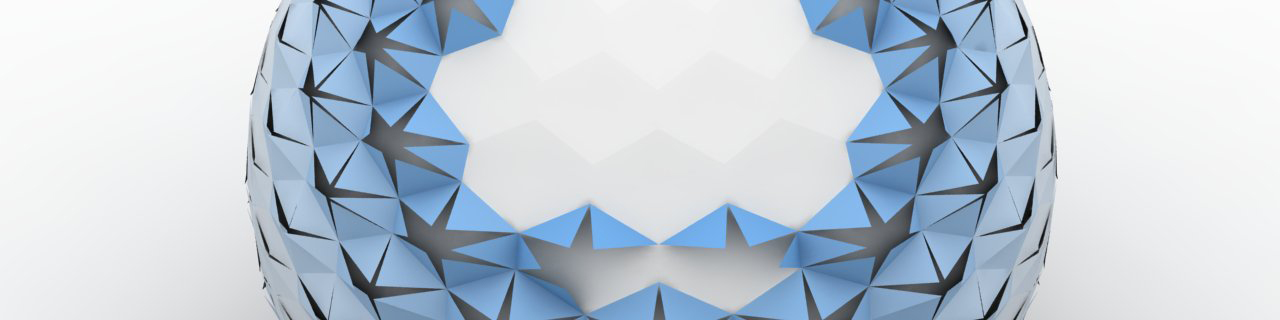
- Panels: honeycomb subdivision of a nurbs surface based on the UV coordinates of an host nurbs surface (here a sphere) - each cells is re-subdivided into planar panels (triangles) which are able to rotate onto the edge they share with the original cell.
- "SUNCARE" : the facade panels are rotating based on a Sun path "analysis" - in that exemple a random arc inclined 45 degree - though can easily be ploted based on the GPS coordinates of the site and the sun data using as parameters the azimuth and elevation (thx to Neil Katz).
- Animation: rhino animation (number of frame according to sun data sampling) where the honeycomb panels open whenever directly exposed to the sun (with decay)...
AZIMUTH AND ELEVATION - an angular coordinate system for locating positions in the sky. Azimuth is measured clockwise from true north to the point on the horizon directly below the object. Elevation is measured vertically from that point on the horizon up to the object. If you know the azimuth of a constellation is 135° from north, and the elevation is 30°, you can look toward the southeast, about a third of the way up from the horizon to locate that constellation. Because our planet rotates, azimuth and elevation numbers for stars and planets are constantly changing with time and with the observer's location on earth.
Labels: azimuth, rhinoscript, rhinoscripting, sun analysis, sun elevation
posted by theverymany at 1/15/2008 07:20:00 am
![]()


<< Home